

Close Menu
  • Home
  • Education
  • Health
  • National News
  • Politics
  • Relationship & Wellness
  • World News
What's Hot

Sam Altman admits AI models 'scare' him and he understands why world is anxious; but wants everyone to take responsibility

September 2, 2026

60 years after Dutch elm disease devastated America’s 100 million iconic trees, now scientists have infected 6,000 young elms in a radical bid to bring them back

September 2, 2026

Two Turkish ships collide off Istanbul; one believed sunk, 10 crew missing

September 2, 2026
Facebook X (Twitter) Instagram
Facebook X (Twitter) Instagram YouTube
Global News Bulletin
SUBSCRIBE
  • Home
  • Education
  • Health
  • National News
  • Politics
  • Relationship & Wellness
  • World News
Global News Bulletin
Home»Business»India's land records go digital: How maps, drones and Bhu-Aadhaar are changing property records
Business

India's land records go digital: How maps, drones and Bhu-Aadhaar are changing property records

editorialBy editorialAugust 31, 2026No Comments4 Mins Read
Facebook Twitter Pinterest LinkedIn Tumblr Email Telegram Copy Link
India's land records go digital: How maps, drones and Bhu-Aadhaar are changing property records
Share
Facebook Twitter LinkedIn Pinterest Email Copy Link
India's land records go digital: How maps, drones and Bhu-Aadhaar are changing property records
How India’s digital mapping works

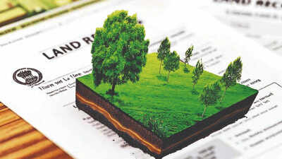
Nearly every textual land record in India is now digital, with 99.90% of Records of Rights (RoRs) computerised. But how does a piece of land on the ground eventually get a digital identity?The answer lies in a mix of digitised maps, georeferencing and unique identification numbers for land parcels. The system was recently showcased to a high-level delegation from the African Union Commission, Ethiopia, Malawi, Rwanda, Sierra Leone and Zambia, along with officials from the United Nations Development Programme (UNDP), during a visit to the Department of Land Resources (DoLR) in New Delhi.The delegation studied the Digital India Land Records Modernisation Programme (DILRMP), Unique Land Parcel Identification Number (ULPIN), also called Bhu-Aadhaar, National Generic Document Registration System (NGDRS) and the NAKSHA programme for urban areas.

From land records to digital identity

Once land records and maps are digitised, the government links the information to the actual location of the land.Around 76.16% of land parcels have been fully georeferenced, while 85.24% spatial-textual integration has been completed between cadastral maps and Records of Rights.India is also giving land parcels their own digital identity. More than 40.58 crore land parcels have been assigned a 14-digit alphanumeric identification number called Bhu-Aadhaar, or ULPIN.Department of Land Resources Secretary Narendra Bhooshan said Aadhaar had created India’s digital identity layer and Bhu-Aadhaar was extending the same idea to land.“Land is the largest and most foundational asset class in any developing economy. In traditional systems, without clear spatial titles and interoperability, vast amounts of land remain ‘dead capital’ that citizens cannot leverage.”He said the aim under DILRMP and the Bharat Land Stack was to build an “unshakeable digital trust architecture”.“By linking georeferenced land records, circle rates, registration, and encumbrances into a single interoperable layer, we are creating an ecosystem where even the most vulnerable citizen or rural landowner can unlock formal credit and mortgages seamlessly. This experience and architecture are open to be shared with our partner nations across Africa to accelerate DPI-led inclusive growth across the Global South.“

What goes into the digital land map?

A digital map of a property is not limited to its location and boundaries. India’s Bharat Land Stack brings together several layers of land and property information.These include satellite and drone images, georeferenced cadastral boundaries, Records of Rights and property registration data. It also includes master plans and zoning rules, building approvals, restrictions and litigation, circle rates and tenancy details.The aim is to bring this information together on a single digital framework and create a common source for land-related information.The property registration system is also being digitised. Around 98.96% of Sub-Registrar Offices (SROs) have been computerised.Seventeen states and Union territories have adopted the centralised NGDRS platform, while 17 states use their own digital registration software.Information on property-related disputes is also being connected to land records. Around 94.11% of Revenue Courts have been computerised under the Revenue Court Case Management System (RCCMS), allowing litigation related to a property to be marked on its record in real time.

Drones for mapping

For urban areas, India is using drones under the NAKSHA programme, or National Geospatial Knowledge-based Land Survey of Urban Habitations. DoLR Director (LR) Shyam Kumar explained the process to the visiting delegation.Drones fitted with 2D Nadir cameras, five-camera Oblique systems and LiDAR sensors are used to survey urban areas to achieve centimetre-level positional accuracy. The aerial surveys are used to create Ortho-Rectified Imagery (ORI), Digital Elevation Models (DEM) and 3D Reality Models, helping map complex urban landscapes.But the process does not end with the aerial survey as the data is checked on the ground using Real-Time Kinematic (RTK) GNSS rovers, along with participatory ground validation.There is also a claims and objections process to address issues raised during the mapping exercise.Under the NAKSHA pilot, aerial flying has been completed across 145 of 150 Urban Local Bodies (ULBs). The exercise has resulted in the issuance of legally authentic Urban Property (UrPro) Cards.

Follow on Google News Follow on Flipboard
Share. Facebook Twitter Pinterest LinkedIn Tumblr Email
Previous ArticleBabar Azam confronted over Pakistan’s alleged Lord’s protest after Imran Khan interview
Next Article Dark energy, exoplanets and black holes: What Nasa’s new Roman telescope will explore
editorial
  • Website

Related Posts

Sam Altman admits AI models 'scare' him and he understands why world is anxious; but wants everyone to take responsibility

September 2, 2026

60 years after Dutch elm disease devastated America’s 100 million iconic trees, now scientists have infected 6,000 young elms in a radical bid to bring them back

September 2, 2026

Two Turkish ships collide off Istanbul; one believed sunk, 10 crew missing

September 2, 2026

Times Square stabbing: Bank of America VP Erin Piacenti among victims

September 2, 2026

‘Pre-event indications’: Did Nepal miss warning signs before deadly floods? What report says

September 2, 2026

WTC dreams run into scheduling roadblock: Irani Cup, Asian Games and ODIs leave little room to prepare before New Zealand and Australia series

September 2, 2026
Add A Comment
Leave A Reply Cancel Reply

Economy News

Sam Altman admits AI models 'scare' him and he understands why world is anxious; but wants everyone to take responsibility

By editorialSeptember 2, 2026

ChatGPT-maker OpenAI CEO Sam Altman has admitted that the rapid rise of AI can be…

60 years after Dutch elm disease devastated America’s 100 million iconic trees, now scientists have infected 6,000 young elms in a radical bid to bring them back

September 2, 2026

Two Turkish ships collide off Istanbul; one believed sunk, 10 crew missing

September 2, 2026
Top Trending

Sam Altman admits AI models 'scare' him and he understands why world is anxious; but wants everyone to take responsibility

By editorialSeptember 2, 2026

ChatGPT-maker OpenAI CEO Sam Altman has admitted that the rapid rise of…

60 years after Dutch elm disease devastated America’s 100 million iconic trees, now scientists have infected 6,000 young elms in a radical bid to bring them back

By editorialSeptember 2, 2026

Six decades ago, Dutch elm disease swept across the United States, killing…

Two Turkish ships collide off Istanbul; one believed sunk, 10 crew missing

By editorialSeptember 2, 2026

10 crew members aboard one of the vessels are unreachable (Representative image)…

Subscribe to News

Get the latest sports news from NewsSite about world, sports and politics.

Facebook X (Twitter) Instagram YouTube

News

  • Education
  • Health
  • National News
  • Relationship & Wellness
  • World News
  • Politics

Company

  • Information
  • Advertising
  • Classified Ads
  • Contact Info
  • Do Not Sell Data
  • GDPR Policy
  • Media Kits

Services

  • Subscriptions
  • Customer Support
  • Bulk Packages
  • Newsletters
  • Sponsored News
  • Work With Us

Subscribe to Updates

Get the latest creative news from FooBar about art, design and business.

© Copyright Global News Bulletin.
  • Privacy Policy
  • Terms
  • Accessibility
  • Website Developed by Plenary Media Solution

Type above and press Enter to search. Press Esc to cancel.